Participatory mapping Capacity building
Engaging North Rupununi Communities in Spatial Thinking: Mapping Is Not the Point
A personal reflection on designing the National Geographic project’s community-engagement process around Indigenous-led storytelling, dialogue, practical mobile tools, and data sovereignty.
-
by Andrea
As we move into the implementation phase of our National Geographic project, Revitalizing Indigenous Education for the Protection of the Rupununi Wetlands, I have been thinking hard about what we mean by “participatory mapping” in this project
From October 2026, we will begin Indigenous community engagement in implementing practical mapping processes for addressing key community challenges. Working with the 20 Wapishana and Makushi communities of the North Rupununi, the project will use the proposed road upgrade as a real-world, problem-based learning case: helping communities explore how changes in the road construction (e.g. how high the road is built, how many culverts and bridges are included) may affect hydrological flows, biodiversity, sacred places, livelihoods, and cultural connections. But we must not start with a predetermined mapping or modelling tool, or with the assumption that a map or model is the main outcome.
The tools people actually use
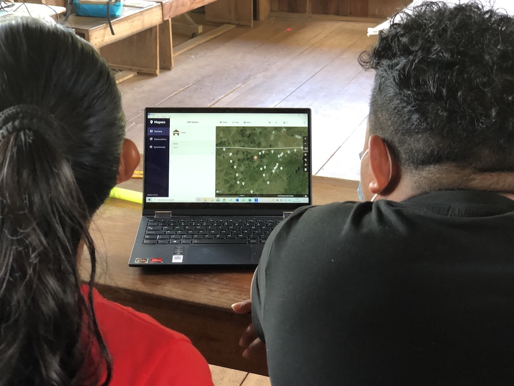
There is now a substantial literature on participatory mapping with Indigenous Peoples and local communities. Much of it focuses on dedicated platforms such as Mapeo and Sapelli. These tools are laudable in their aims. They have been developed with communities, can work offline, and make space for local symbols, media, and language. Yet, in more than 25 years of engagement with Indigenous communities of the North Rupununi, I have repeatedly found a gap between the tools that are written about and the tools that communities actually use when project funding, external technical support, and researchers’ enthusiasm are no longer present.
In my observations of community day-to-day mapping in the North Rupununi, the tools that tend to be used are often free Android applications: Locus, Avenza, KoboCollect, and similar tools that people can download onto phones. When more sophisticated analysis is needed, Indigenous practitioners may bypass the limited functionality - and often bugginess - of specialist “participatory mapping” platforms and go straight to QGIS. When they want to share multiple maps quickly online, exporting KMZ files from Locus, uploading these in to Google My Maps, and then sharing the online map link to a community WhatsApp group is often more useful and practical than a bespoke system.
What attracts people to these tools is not necessarily that they have been co-designed or branded as participatory. It is their simplicity, their ability to work on a phone rather than a laptop, and the ease with which information can be rapidly shared through WhatsApp. For example, someone can go out and collect the location of an illegal gold mine, a blocked creek, a mass fish die-off, a flooded crossing, or a new road impact. They can embed a photograph, short video, or voice recording in to a Locus map point; post the Locus map point immediately into a village WhatsApp group; others download the point and associated media onto their own Locus app, reflect on what they see, its location, their experience, and kick-start a digital and face-to-face discussion about what is happening and what should be done. That, to me, is participatory mapping in action.
The participatory element is not necessarily a group of people huddled around a laptop looking at a map on a bespoke tool. It is the way a location and associated image, video, or audio recording becomes part of a collective process of discussion, interpretation, concern, decision-making, and action.
GIS is not neutral
This reflection matters because conventional GIS is often treated as a neutral technical language into which Indigenous knowledge can be added. But GIS carries its own assumptions about what space is: coordinates, boundaries, points, lines, polygons, layers, scale, distance, categories, and fixed representations. These assumptions can be useful. Indigenous communities may need to use them strategically to map customary use, support land demarcation, demonstrate the location of threats, or communicate with government agencies, engineers, and conservation organisations. There is no question that maps can be powerful tools in asserting land, forest, resource, and access rights.
But it is important not to confuse this strategic use of GIS with the integration of knowledge systems.
Traditional Indigenous knowledge systems do not necessarily understand or communicate space through kilometres, miles, coordinates, or straight-line distance. Distance may be expressed as “two days’ walk away,” through the time, effort, risk, and seasonal conditions involved in a journey, or through the landmarks that lie between one place and another. Similarly, Indigenous space is often communicated through journeys and stories: historical events, spiritual powers, dangerous places, resource locations, named people where they live, seasonal changes, and relationships with animals, water, forest, and ancestors. A mountain is not simply a dot or label on a flat two-dimensional map. It is a massive physical presence, a point in a journey, a place of memory, a potential danger, a source of resources, or a spiritual connector.
There is therefore a radical incompatibility between traditional knowledge systems and mapping technologies as they are conventionally practised. Adding traditional icons, audio clips, photographs, or videos into a GIS layer does not solve this. It may be useful, but it can also be tokenistic and superficial: traditional knowledge is still being asked to fit into a techno-scientific system of representation.
Putting maps into stories
For our National Geographic project, the question is not simply how to put stories, audio, video, and Indigenous icons into maps. It is how to put maps and spatial information into stories. A more meaningful approach may begin with oral storytelling, conversation, and collective interpretation. A story may describe a route, a creek, a flooded savanna, a place of spiritual importance, an area where fish spawn, or an event that changed the landscape, such as a devastating wildfire. A map can then support that story: it can help communicate spatial relationships to younger people, neighbouring communities, policy-makers, and external institutions. But the map should not become the authority that replaces the story.
This is why tools such as ESRI’s StoryMaps may have potential: a written narrative - which can be read aloud, used to guide oral storytelling, or complemented with audio and video recording’s of people recounting an event, a myth, a vision - can contain maps where they are useful. The spatial information supports the story, rather than demanding that the story becomes just another layer on a map. The same applies to WhatsApp. A georeferenced photograph, a location, a drone image, or a short video can trigger a collective discussion, often through voice notes rather than written text. That dialogue is not an incidental add-on to mapping. It may be the core of a traditional knowledge-led digital mapping process: collective, subjective, narrative, and grounded in relationships.
Data sovereignty is practical
This also sharpens how we think about Indigenous data sovereignty. It cannot remain an abstract principle or be reduced to a consent form and a promise to share the finished maps back with communities.
For this project, data sovereignty must mean community control over the full mapping-data cycle: • Who decides what problem is worth investigating? • What knowledge can be mapped, and what should never be recorded or shared digitally? • Who collects spatial data, and with whose authority? • Where does information live: on a phone, a local device, a community server, a cloud platform, or an external organisation’s system? • Who can add, view, edit, analyse, share, or delete data? • How are different levels of access decided for sacred, sensitive, gender-specific, or politically risky knowledge? • How will information be used in village discussions, Village Sustainability Plans, advocacy, or negotiations over the road?
Beginning with listening
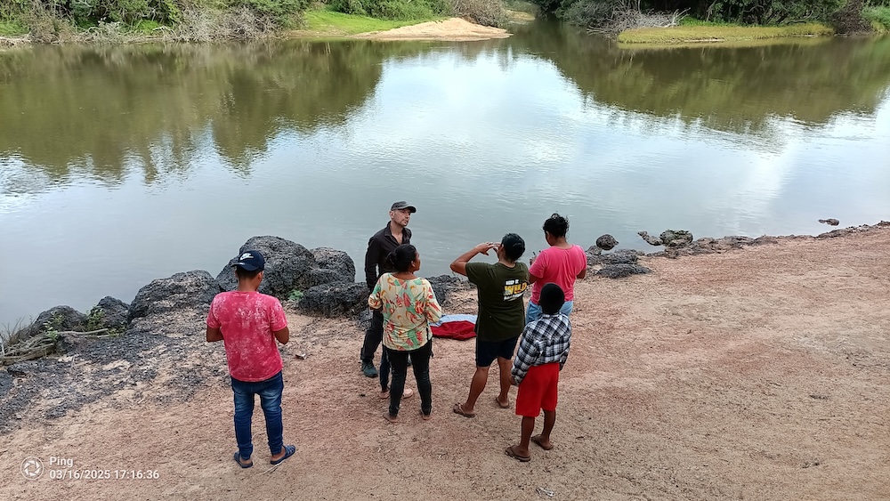
When community engagement begins in October, we will not arrive with a finished platform and ask people to use it. We will begin by listening. We will ask what mapping and communication tools people already use; what ecological and cultural changes they want to understand; what information they need to act upon; what should remain private; and how young people, elders, women, village councils, and Community Support Officers want to work together.
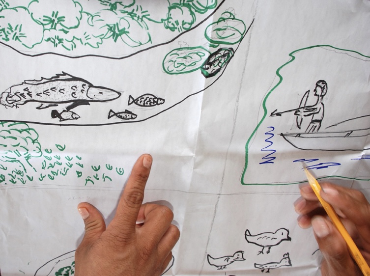
Some communities may want paper maps, seasonal calendars, story circles, and field walks. Some may want drones, satellite imagery, phone-based data collection, WhatsApp groups, or a combination of these. Some may want community maps to remain entirely local. Others may want to use selected evidence in discussions with government agencies or road planners. The point is not to make every community use the same digital platform. The point is to co-design tools and processes that support - rather than undermine - Indigenous approaches to sharing knowledge, interpreting change, making decisions, and protecting the Rupununi Wetlands.
If we do this well, the project will not be about teaching communities to become better GIS users. It will be about supporting them to use spatial information on their own terms: to reclaim, express, and protect the connections between water, territory, culture, and identity.